To serve you better, our new website displays information specific to your location.
Please visit the site and bookmark it for future use.
The new role of surface geochemistry
Author(s):
Oliver Bayley, Russill Birrell
Date:
Tuesday, November 12, 2019
First presented:
SRK Insights
Type:
Article
Category:
Geochemistry
|
Recent significant advances in multielement analytical technology, understanding element migration and recognition of large element and alteration halos associated with metal deposits have put surface geochemistry back at the forefront for exploration.
|
||
| Why use it? | What can be done? | |
|
Mainly regional scale:
|
Regional and local scales:
|
|
Cost Effective Exploration at Regional Scales – Zambia Case Study
Reference: Using Multielement Geochemistry to Map Multiple Components of a Mineral System: Case Study from a Sediment-hosted Cu-Ni Camp, NW Province, Zambia. Scott W. Halley et.al., January 2016, SEG Newsletter Number 104, p. 15-21
Conclusions: Footprints of mineral deposits are orders of magnitude smaller than the footprints of the systems that form those deposits – it is cheaper and quicker to define the footprint of a system and then look for the orebody within.
|
||
|
Costs for the 1900 km2 Project Area:
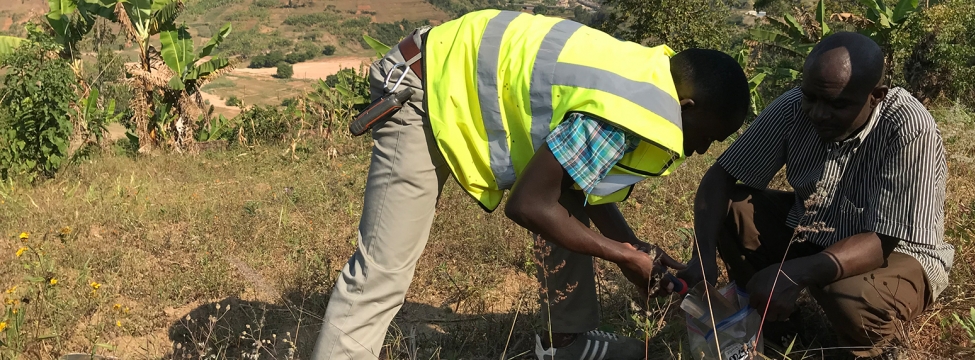
Soil Survey: US$0.9M (or US$0.1M). 300 x 300 m sampling took 12 months to complete including sampling, analyses, interpretation and reporting, although results show that reducing sample density to 1 x 1 km would have delivered similar outcomes at reduced cost (US$0.1M).
Geophysical Survey: US$1.8M. Not including processing time and ground truthing and mapping. |
Survey Outcomes:
Soil Survey: Identified new metal targets, mapped proxies for geology, alteration, and metal zoning patterns – clearly mapped the mineral system hosting already known deposits.
Geophysical Survey: Used with ground verification to help create a lithological and structural map.
|
|
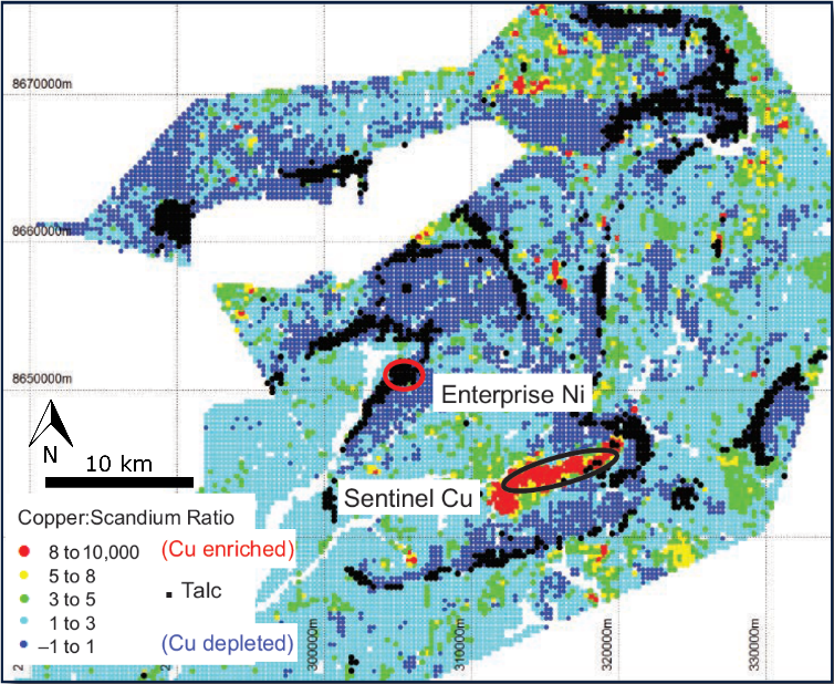 |
Map of Cu:Sc highlighting zones of Cu depletion (dark blue) and Cu enrichment (red). Cu:Sc ratio used to normalise Cu within silicates.
The depleted zones outline the footprint of a regionally extensive oxidized acidic hydrothermal system.
Talc (black) is also inferred from geochemical response and occurs below the redox boundary within quartz sandstones of the Lower Roan.
Enterprise and Sentinel Deposits are the only known locations of reduced rock within the oxidized part of the system.
|
|